Cloud Infrastructure For
Advanced Mapping.
The premier cloud platform for GIS engineers and spatial data teams. Full ESRI protocol parity, robust REST APIs, and real-time vector hosting built on uncompromising infrastructure.
Core Infrastructure & API Ecosystem
Seamlessly integrate with your existing GIS stack. We speak the language of enterprise mapping natively.
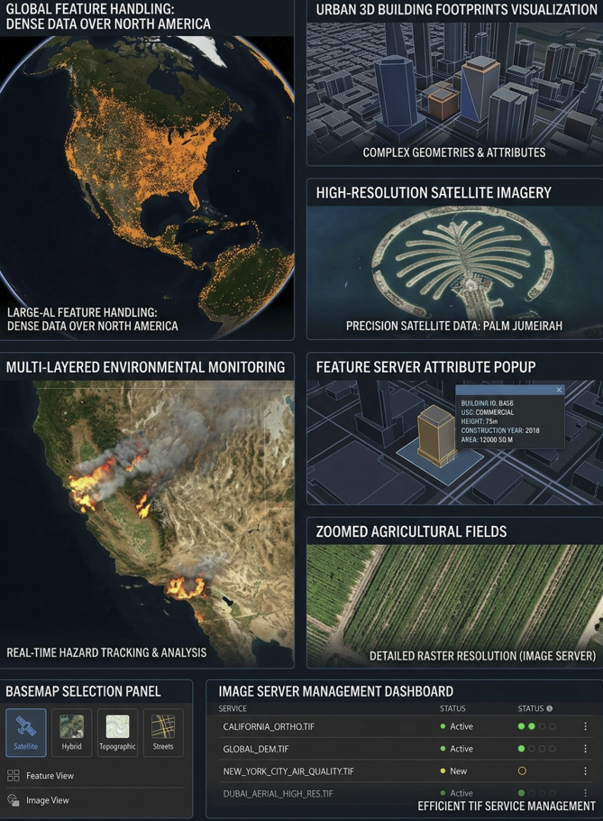
FeatureServer
Advanced Feature Streaming
Full compatibility with FeatureServer protocols for real-time vector data streaming and multi-user editing. Supports advanced querying and precise management of city-scale infrastructure and geographic boundaries.
View EndpointsImageServer
Enterprise Image Services
Complete REST API ecosystem including the Export Image REST API. Designed for advanced data extraction, dynamic raster rendering, and planetary-scale mosaicking for external application integration.
View EndpointsSceneServer
3D Digital Twin Infrastructure
Integrated 3D building layers with high-fidelity node streaming. Provides exact height, volume, and elevation metrics, optimized for I3S payload delivery and complex digital twin environments.
View Endpoints02 // Infrastructure
Next-Gen Data Architecture.
Advanced visualization and metadata management for enterprise geospatial assets. Query petabytes of temporal earth observation data in milliseconds with our PostGIS-powered indexing engine.
3D SceneServer Support
Integrated 3D building layers with high-fidelity rendering, providing exact height, volume, and elevation metrics for digital twins.
STAC-Native Implementation
Efficient discovery and management of time-series satellite imagery and large geospatial datasets using the Spatial Temporal Asset Catalog.
Secure Authentication & Access
Enterprise-grade User Manager with Role-Based Access Control (RBAC) to securely manage Feature and Image Server endpoints.
Seamless Data Delivery
Optimized architecture for high-speed delivery of raw raster imagery and complex vector features directly to ArcGIS and web platforms.
Developer-First
Rest API.
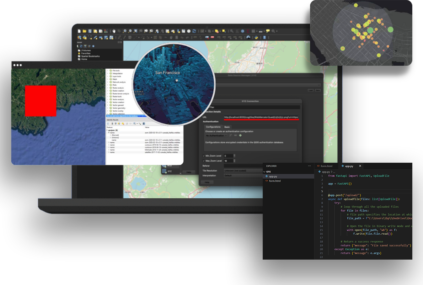
Don't fight the infrastructure. Our REST API ecosystem provides granular control over every aspect of your geospatial data, accompanied by extensive documentation and generated SDKs.
- OpenAPI 3.0 Specifications
- Type-safe Client Generation
- Webhook Event Subscriptions
- Granular IAM & Token Scopes
const response = await client.imageserver.exportImage({
  bbox:          '-122.41,37.77,-122.39,37.81',
  bboxSR:        4326,
  size:          '1024,1024',
  imageSR:       3857,
  format:        'tiff',
  renderingRule: { rasterFunction: 'NDVI' }
});

// Returns cloud-optimized GeoTIFF in < 50ms
if (response.ok) {
  renderLayer(response.url);
}


Cloud Optimized/
Cloud Native Data Serving as URL
-
FlatGeoBuf
-
COG – Cloud Optimized GeoTIFF
-
COPC – Cloud Optimized Point Cloud
-
PMTILES
-
Zarr
-
NETCDF & Other
Upload Regular GeoTIFF and Cloud Optimized GeoTIFF (COG) and be able to consume them as
-
OGC WMS
-
ESRI ImageServer
(without the ESRI Licensing and per user pricing)
-
Advanced Raster Functions and Calculations support for multiband multispectral imagery
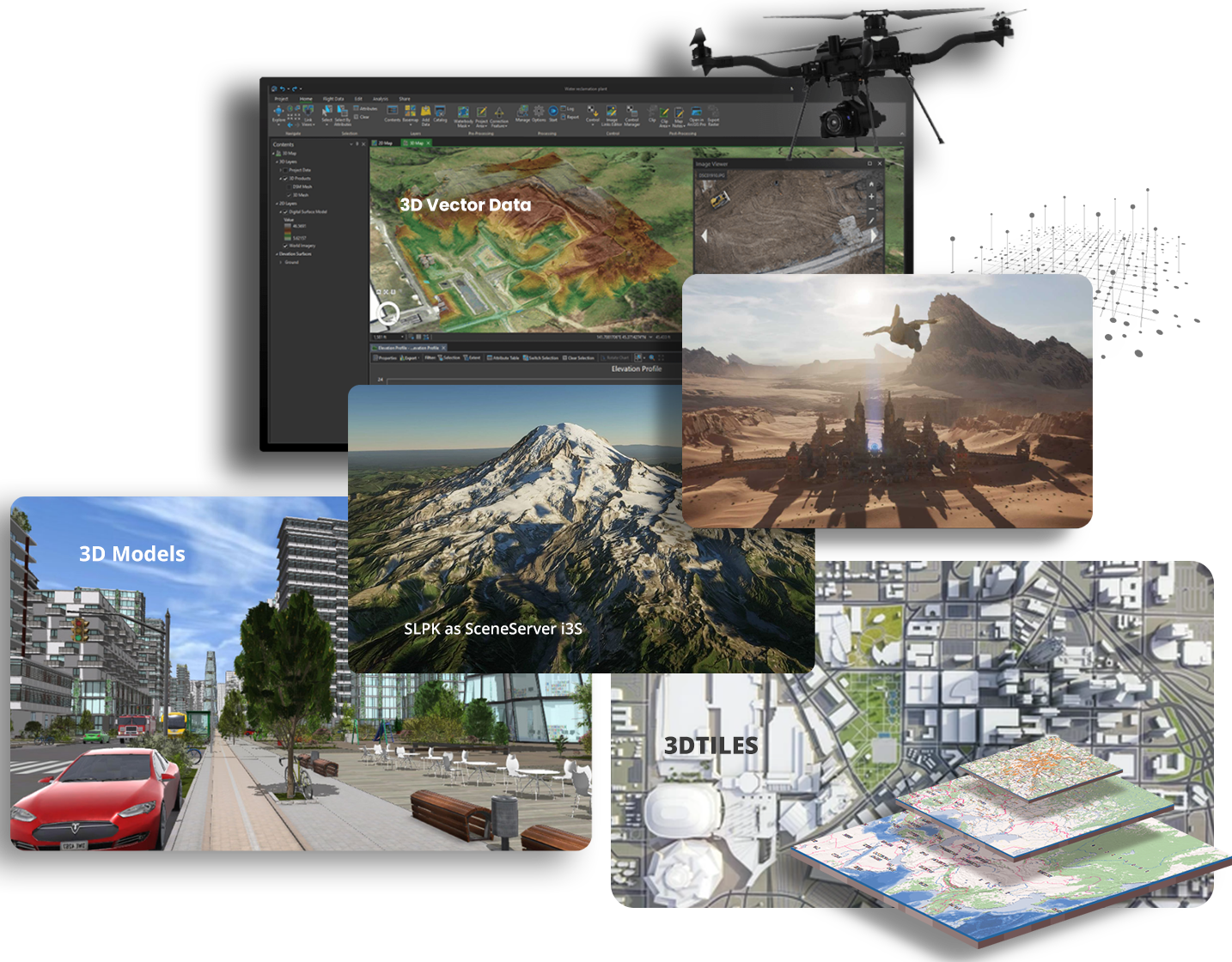
3D Digital Twin Converter:
Convert to SLPK and served as OGC i3S SceneServer (without the ESRI Licensing)

or Convert to OGC 3DTILES
from:
-
3D ESRI Multipatch SHP and FileGDB
-
3D GPKG, KML and Other GIS Formats
-
3D CAD DWG, DXF, DGN
-
3D CityGML and CityJSON
-
BIM Data Formats
Convert 3D Models
-
3D Models 40+ types converted to GLB GL Binary Transmission Format
Publish 3D Geometry enabled postgis tables and take advantage of PostGIS 3D Spatial Operations/Functions and editing
Mobile Disconnected Offline Integration
back-end for Mobile Apps:
Clip existing cached map tiles (mbtiles and gpkg)
Download GeoPackage Vector Features and other formats from PostGIS Database tables
Download Online Map Tiles and Dynamic and cached map services
Synchronize Field Edits
Tile Conversion API (to/from different tile formats)
- ESRI Tile Package (TPKX, VTPK)
- OSMDroid SQLite
- MBTILES
- PMTILE
- GPKG GeoPackage


Embracing and Supporting Open Standards Ease of Compatibility and integration into
-
Desktop GIS (QGIS Desktop, ArcGIS Pro, ArcMap, Global Mapper, Manifold, MapInfo, SAGA, QVSIG, UDIG, others)
-
Mobile Mapping Apps
-
Web Apps
-
Game Engines

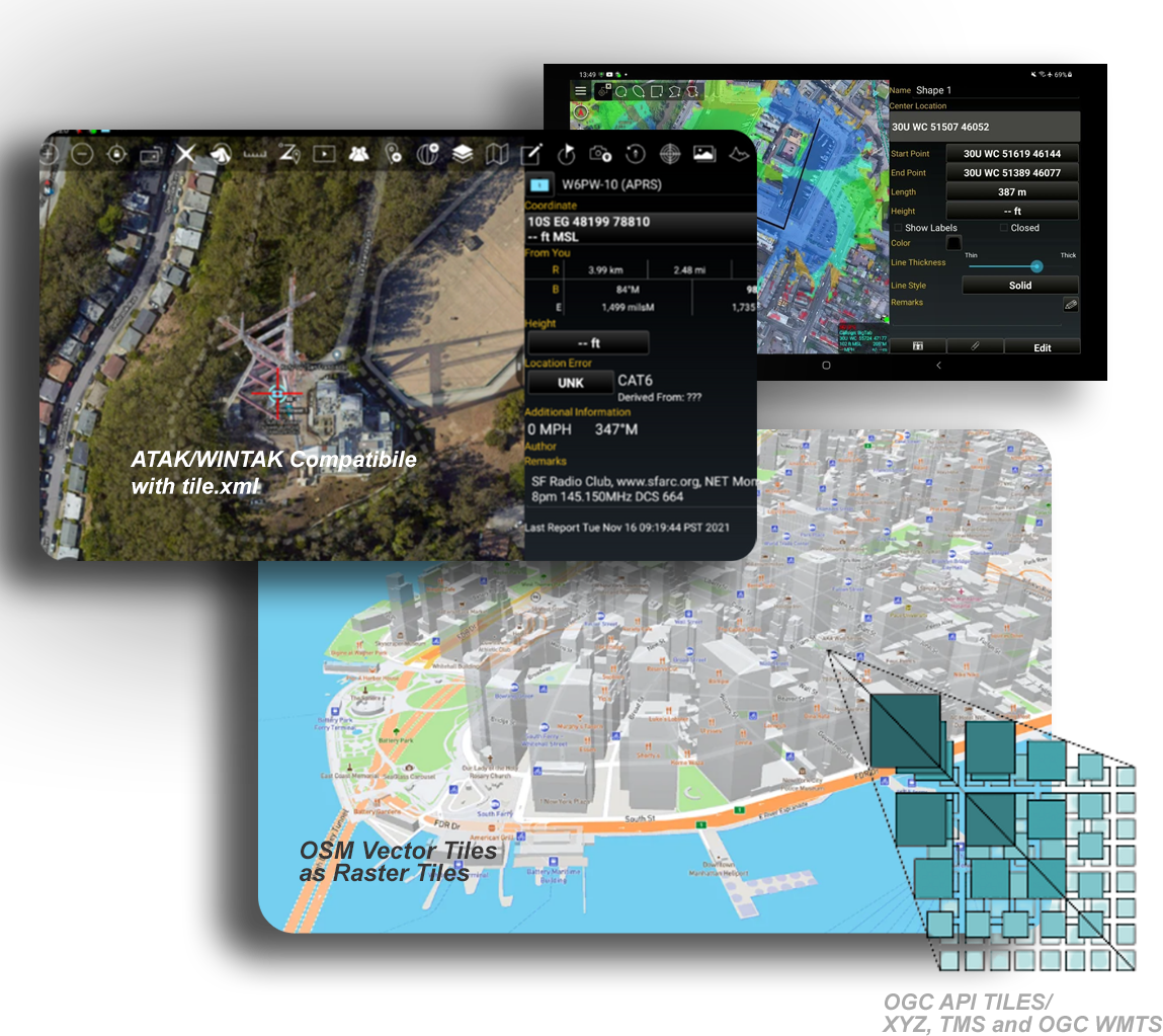
OSM Style (open street map)
Works with OSM Vector Tiles and Rasterizes them to Different Stylesheets
Supports Caching (building raster tiles) of an area of interest and zoom level range for speeding up performance of the Vector to Raster and Tile Group
Tile Group – Blend/Merge multiple tile layers
Tile Group – Build Satellite Hybrid Tiles
Tile Group – Build Topo/Terrain Tiles with hillshade and contour lines
Tile Group – Add your own overlays to the predefined styles
Mapping and Data Visualization with the integrated Maps
Find a list of guides on how to setup all external data lake providers and services.
How data get’s in/out of the system
Upload API
Transactional API (supports appending to PostGIS)
3D Map
Catalog Generator for 2D and 3D Map
Serving Map Catalogs
2D
Create Published Maps Public or Private
We have a Companion QGIS Desktop Plugin
that Makes it Easy to Load and Manage Data
Team Collaboration Capabilities:
")
- Share your Geolocation - PLI
- See Teams Location On the Map
- Create and Manage Geofences - Areas to Stay in Or stay Outside of with Notifications and Alerts
- Advanced Messaging with Attachments
- Send Status Reports
- Create Advanced Forms with Form Builder
- Share Geospatial Data
- Subscribe to Real-time Data Feeds Server-Sent Events and Hooks